Topographic Map of the City of Alpena 1961
Description
- Creator
- R.S. Scott Engineering Company Inc.
- Media Type
- Image
- Item Type
- Maps
- Description
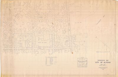
- A Topographical map of the city of Alpena compiled and photographed by the R.S. Scott Engineering Company Inc. in 1961.
- Notes
- - Sheet 1 of 6
- Map shows Dunbar St. to Hitchcock St. and W. Washington Ave to State Ave. - Publisher
- R.S. Scott Engineering Company Inc.
- Place of Publication
- Alpena, MI
- Date of Publication
- 1961
- Dimensions
-
Width: 56
Height: 36
- Map Scale
- 1 in = 50 ft
- Subject(s)
- Corporate Name(s)
- R.S. Scott Engineering Company Inc.
- Local identifier
- OS 18-9
- Collection
- Rich Shultz Collection
- Geographic Coverage
-
-
Michigan, United States
Latitude: 45.06168 Longitude: -83.43275
-
- Copyright Statement
- Copyright status unknown. Responsibility for determining the copyright status and any use rests exclusively with the user.
- Copyright Date
- 1961
- Recommended Citation
- Rich Schultz Collection, Alpena County George N. Fletcher Public Library. Alpena, MI
- Contact
- Alpena County George N. Fletcher Public LibraryEmail:specialcollections@alpenalibrary.org
Website:
Agency street/mail address:211 N. First Ave.
Alpena, Michigan 49707
USA
(989)356-6188