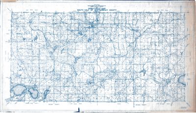
Farm-Forest Map of South Half of Montmorency County, Michigan (1930)
Description
- Creator
- Michigan Department of Conservation Land Economic Survey Division
- Media Type
- Image
- Item Type
- Maps
- Description
- A 1930, map showing farm and forest lands from the Southern half of Montmorency County by the Michigan Department of Conservation Land Economic Survey.
- Date of Publication
- 1930
- Dimensions
-
Width: 52 in
Height: 30 in
- Map Scale
- 2 in = 1 Mile
- Subject(s)
- Corporate Name(s)
- Michigan Department of Conservation
- Local identifier
- OS 19-8
- Collection
- Rich Schultz Collection
- Language of Item
- English
- Geographic Coverage
-
-
Michigan, United States
Latitude: 45.03334 Longitude: -84.13334
-
- Copyright Statement
- Copyright status unknown. Responsibility for determining the copyright status and any use rests exclusively with the user.
- Copyright Date
- 1930
- Recommended Citation
- Rich Schultz Collection, Alpena County George N. Fletcher Public Library. Alpena, MI
- Contact
- Alpena County George N. Fletcher Public LibraryEmail:specialcollections@alpenalibrary.org
Website:
Agency street/mail address:211 N. First Ave.
Alpena, Michigan 49707
USA
(989)356-6188


