Results
We found
3024
matching items
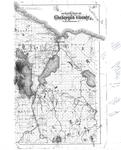
- A map showing farm and forest lands from the North part of Cheboygan County with a zoomed-in view of the city of Cheboygan from 1932, by the Michigan Department of Conservation Land Economic Survey.A map showing farm and forest lands from the North part of …
- A master conservation plan for Cheboygan County made by the Michigan Department of Conservation in 1938.A master conservation plan for Cheboygan County made by the Michigan Department …
- A map showing farm and forest lands from the South part of Cheboygan County in 1932, by the Michigan Department of Conservation Land Economic Survey.A map showing farm and forest lands from the South part of …
- A map showing farm and forest lands from the Central part of Cheboygan County in 1932, by the Michigan Department of Conservation Land Economic Survey.A map showing farm and forest lands from the Central part of …
- A copy of a 1902, map from an unknown source showing Cheboygan county with handwritten historical notes on the right side.A copy of a 1902, map from an unknown source showing Cheboygan …
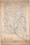
- A map showing farm and forest lands from the North half of Montmorency County by the Michigan Department of Conservation Land Economic Survey in 1930.A map showing farm and forest lands from the North half of …
- A 1930, map showing farm and forest lands from the Southern half of Montmorency County by the Michigan Department of Conservation Land Economic Survey.A 1930, map showing farm and forest lands from the Southern half …
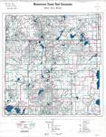
- A 1967 map showing roads and highways within Montmorency County by the Montmorency County Road Commission.A 1967 map showing roads and highways within Montmorency County by the …
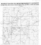
- A copy of a pre-1920s map detailing the early days of Montmorency County, MI with railroad tracks, post offices, schools, and sawmills highlighted.A copy of a pre-1920s map detailing the early days of Montmorency …
- A map of Presque Isle County, Mich drawn by Fredrick Loud for the Presque Isle County Road Commission from an unknown year.A map of Presque Isle County, Mich drawn by Fredrick Loud for …
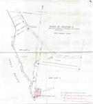
- A map detailing a section of land next to Grand Lake in Presque Isle County, Mich from an unknown source in 1944.A map detailing a section of land next to Grand Lake in …
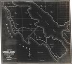
- A map of Grand Point in the township of Krakow Presque Isle County, MI for owners H.A & F.G. Kurrasch. Surveyed by S.J. Davison around 1946.A map of Grand Point in the township of Krakow Presque Isle …
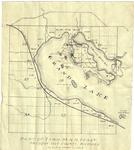
- A map highlighting the northwestern portion of Grand Lake in Presque Isle County, MI from an unknown year.A map highlighting the northwestern portion of Grand Lake in Presque Isle …
- Collapse of the Ninth Street Bridge across the Thunder Bay River, Alpena, Michigan during the flood of April 1923.Collapse of the Ninth Street Bridge across the Thunder Bay River, Alpena, …
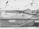
- Alpena Power Company's Norway Point Dam (aka Seven Mile Dam) across the Thunder Bay River in Alpena County, Michigan during late construction. Built 1923-1924 as an electrical plant and to control SpAlpena Power Company's Norway Point Dam (aka Seven Mile Dam) across the …
- Trelfa number 4-1990. Original image damaged - looks to be a peeling negative.Trelfa number 4-1990. Original image damaged - looks to be a peeling …
- Collapse of the Ninth Street Bridge across the Thunder Bay River, Alpena, Michigan during the flood of April 1923.Collapse of the Ninth Street Bridge across the Thunder Bay River, Alpena, …
- Collapse of the Ninth Street Bridge across the Thunder Bay River during the flood of April 1923. Alpena County, Michigan.Collapse of the Ninth Street Bridge across the Thunder Bay River during …
- Alpena Power Company's Ninth Street Dam and Powerhouse across the Thunder Bay River in Alpena, Michigan.Alpena Power Company's Ninth Street Dam and Powerhouse across the Thunder Bay …
- Aerial view from Potter Hill Farm (center lower left) to Four Mile Dam (upper left) along the Thunder Bay River and Long Rapids Road, Alpena County, MichiganAerial view from Potter Hill Farm (center lower left) to Four Mile …


